John S. McCain III
National Center for Environmental Conflict Resolution
Project Case Summaries
The case studies linked below may refer to the U.S. Institute for Conflict Resolution, which is now called the John S. McCain III National
Center for Environmental Conflict Resolution. For more information about the name change, please see the
FAQ section.
ACF River Basin - Stakeholder Group
The Apalachicola-Chattahoochee-Flint River Basin (ACF) spans over 19,000 square miles, and is a source of fresh water for Alabama, Florida, and Georgia. Water use and allocation in the basin has been in dispute and litigation for more than 20 years.
...read more
Alaska Environmental Streamlining Interagency Collaboration
In early 2004, at the request of the Alaska Division of the Federal Highway Administration (FHWA), the U.S. Institute for Environmental Conflict Resolution and Roster Member Louise Smart, from CDR Associates in Boulder, Colorado, conducted an assessment of interagency and intergovernmental coordination challenges among federal and state transportation agencies, including Alaska Department of Transportation and Public Facilities (ADOT&PF), and environmental agencies in Alaska.
...read more
Bankhead National Forest Health and Restoration Plan
The USDA Forest Service was seeking ways to engage affected parties in developing a Forest Health and Restoration Initiative for the Bankhead National Forest in Alabama. Controversy and mistrust had characterized public reaction to Forest Service management of the Bankhead in recent years. The Forest Service wanted to reverse this trend and create a more inclusive environment for forest management.
...read more
Barry M. Goldwater Range: Military Training and Protection of Endangered Species

The Barry M. Goldwater Range (Goldwater Range) is one of the premier combat aviation training ranges available to the Department of Defense and will remain critical to the military readiness of the armed services into the foreseeable future. At the same time, the Range comprises 42 percent of the current U.S. habitat for the endangered Sonoran pronghorn and is necessary to the recovery of the species.
...read more
BLM Bridgeport Land Sale Mediation
Since 1995, the Bridgeport Indian Colony had been interested in purchasing about 40 acres adjacent to the reservation from the Bureau of Land Management (“BLM”). But concerns of town residents regarding the tribe’s commercial development plans and the potential impact on traffic, local businesses, taxes, and the environment blocked the sale, which ended up in a federal appeal process
...read more
BLM Scattered Apples Timber Sale Mediation

Together with a conservation group, residents of Williams, Oregon filed a lawsuit against the U.S. Bureau of Land Management (BLM) over a timber sale. This led the BLM and other affected parties to request the assistance of the U.S. Institute. The U.S. Institute worked with contracted mediators to conduct an initial assessment of the situation.
...read more
California Pilot Workshop on ESA Consultation
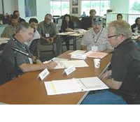
An interagency pilot program launched in California set the stage to create timely and effective consultations related to protected species issues and new transportation projects.
...read more
Coeur d’Alene Lake Management Plan
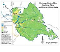
Mining upstream of Lake Coeur d’Alene in the Silver Valley has resulted in the deposition of sediments containing zinc, lead, and other dissolved metals around the bottom of the lake. Bunker Hill Mining and Metallurgical Complex Superfund site is upstream of the Lake and requires a Lake Management plan to address potential issues related to metals in the lake sediments.
...read more
Dixie-Fishlake Forest Plan Revision
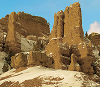
The Dixie and Fishlake National Forests are designated as two separate forests, yet they share many resource issues and have similar landscapes. In 2001, supervisors for both forests decided to work together to revise forest plans that had been in place since 1986. The Institute worked with the Forest Service to develop a collaborative process including local stakeholders. The goal was to develop a common vision for future management of the forests. Stakeholders were engaged early in the process to propose forest plan revisions.
...read more
EPA-Quapaw-Oklahoma Water Quality Assessment and Design
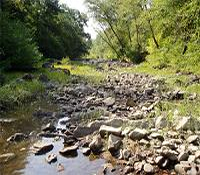
The Quapaw Tribe, State of Oklahoma, and the U.S. EPA Region 6 asked the U.S. Institute to determine the potential for assisted negotiations in the development of a Cooperative Agreement addressing water quality standards among the State of Oklahoma, the Quapaw Tribe, and the U.S. EPA Region 6. The assessment revealed an interest on the part of the state and tribe to continue negotiations.
...read more
Everglades Collaborative Water Management Planning

Congress authorized the Comprehensive Everglades Restoration Plan (CERP) in 2000. The plan represents the largest ecological restoration project in history. It is expected to cost over $10.5B and take 30 years to complete. It will integrate how excess water is stored in south Florida so that it can be used to support restoration of the Everglades ecosystem. Yet moving forward required participating agencies to transform a 20-year history of mutual tensions and mistrust into effective working relationships.
...read more
FHWA - ACHP Section 106 Training
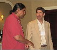
Section 106 of the National Historic Preservation Act requires federal agencies to consult with Tribes when any federal action may affect historic and cultural resources. The Advisory Council on Historic Preservation (ACHP) partnered with the Federal Highway Administration (FHWA) to train FHWA and State Department of Transportation (DOT) staff on consulting with Tribes during transportation planning and project development.
...read more
Illinois Section 106 Tribal Consultation Workshops
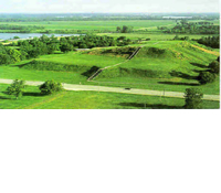
In 2008, the Illinois Division of the Federal
Highway Administration (FHWA), and the Illinois
Department of Transportation (IDOT) expressed
interest in enhancing communication and building relationships with Native American Tribes with historic and ancestral ties to present-day Illinois. At their request, the U.S. Institute for Environmental Conflict Resolution brought together a planning team comprised of agency and tribal representatives to plan and convene a collaborative workshop to address Section 106 consultation on Illinois transportation projects.
...read more
Inyo National Forest Sherwins Area Trails Collaboration
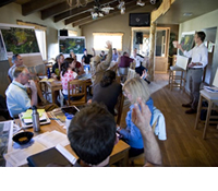
The Sherwins Area located just south of Mammoth Lakes, CA, is a picturesque area of public land managed by the Inyo National Forest (INF) and is a popular recreation spot year-round. Many people enjoy the area for hiking, snowmobiling, back country skiing, etc., which has caused conflicts among users as well as with people interested in conserving the area.
...read more
Inyo, Sequoia, Sierra, and Stanislaus National Forests Travel Management Planning
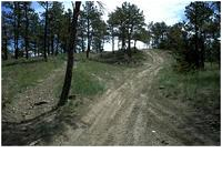
Four California national forests – the Sierra, Sequoia, Inyo, and Stanislaus – simultaneously initiated their travel management planning efforts in early 2009. The goal was to develop an integrated approach to travel management planning that maximized public participation and resulted in the drafting of widely supported proposed actions for each of the forests.
...read more
Issue-Based Multi-Party Negotiation Training

In partnership with the U.S. Department of
Interior’s Office of Collaborative Action and
Dispute Resolution, the U.S. Institute
Environmental Conflict Resolution delivered a one-day multi-party negotiation workshop for the
Office of Surface Mining and the U.S. Fish &
Wildlife Service. The training was based on a real-life conflict
among the two agencies, the coal mining industry,
and various state agencies over mining activities
and the protection and conservation of endangered
bat species and critical habitat.
...read more
MCAS Yuma-Yuma County Airfield Access Mediation
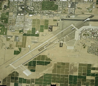
The County of Yuma, Arizona, and the U.S. Navy asked the U.S. Institute to mediate a dispute over the value of a 129-acre parcel owned by the County adjacent to the Marine Corps Air Station Yuma (MCAS). The Navy sought to incorporate the parcel into the air station but could not agree with the County on a price for the parcel. No lawsuit was pending, but the Navy had signaled that it would file a lawsuit if the parties were unable to reach an agreement on a selling price.
...read more
Military Community Compatibility Committee (MC3)

Aircraft noise from training flights at the Davis Monthan Air Force Base has long been an issue for Tucson residents who live and work near the base. In 2005, as the conflict began to escalate, community leaders asked the U.S. Institute for help. The Institute brought members of the affected community together for dialogue. The group agreed to work on minimizing the impacts of aircraft noise on residential neighborhoods while maintaining the viability of the base. The U.S. Institute helped the group select a facilitator for their discussions over the next year.
...read more
MN-WI St. Croix R. Crossing/Stillwater - Phase 2
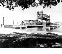
In the 1950s, Stillwater, Minnesota, and Houlton, Wisconsin, began discussing how to improve local transportation. The towns are currently connected by an historic lift bridge over the St. Croix River, a waterway within the Wild and Scenic River System. In 1995, federal and state transportation agencies decided to build a new bridge and remove the lift bridge. But an environmental group successfully challenged this decision in court. By 2000, the intersection of three public policy goals – enhancement of transportation services, preservation of historic resources, and protection of a wild and
...read more
Mt. Hood National Forest Recreation Management Plan: Collaborative Intervention
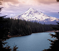
The Mt. Hood National Forest covers 1.1 million acres in Northwestern Oregon. The forest receives more than six million national and international visitors annually. It also serves as an urban national forest for residents of Portland and Vancouver who live within a two-hour drive of the Forest.
...read more
National Bison Range Complex Facilitation
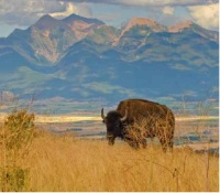
Established in 1908, the National Bison Range is administered by the U.S. Fish and Wildlife Service as a National Wildlife Refuge with the goal of conserving the American Bison. The National Bison Range Complex, located in Moiese, Montana, consists of the National Bison Range, Pablo, and Ninepipe National Wildlife Refuges, and a portion of the Northwest Montana Wetland Management District. In addition to its mission to conserve the American Bison, the Complex provides important habitat for a variety of other species such as elk, pronghorn antelope, and migratory birds.
...read more
National Park Service - U.S. Geological Survey
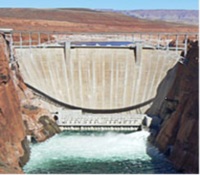
The Glen Canyon Dam, completed in 1963, sits just outside Grand Canyon National Park. The dam provides hydroelectric power for 200 wholesale customers in six Western States, and it is an important component of the Nation’s western electrical grid system, but it has affected the flow and temperature of the Colorado River. The U.S. Geological Survey's Grand Canyon Monitoring and Research Center (GCMRC) is the science provider to the Glen Canyon Dam Adaptive Management Program. In this role, the U.S. Geological Survey (USGS) provides scientific information to the National Park Service (NPS) regar
...read more
New Mexico Collaborative Forest Restoration Program
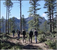
Authorized by Congress in 2000, the Collaborative Forest Restoration Program (CFRP) established a new and innovative program in New Mexico to provide grants for collaborative forest restoration projects on public land. Prior to the creation of the program, New Mexico forests had been mired in conflict. Years of fire suppression, logging, and grazing had brought forests to an unhealthy state. In the 1990s, following a federal decision to list the Mexican spotted owl as an endangered species, and a long period of overharvesting, the regional timber industry collapsed. After that, environmentali
...read more
NPS - Cape Hatteras National Seashore ORV Reg-Neg
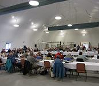
A Negotiated Rulemaking process was convened aimed at developing broad-based consensus on an Off-Road Vehicle (ORV) Management Plan and implementing regulations for Cape Hatteras National Seashore. Those involving in the process were unable to reach full consensus on an ORV rule, but were able to provide other information that will be of value to the NEPA process.
...read more
Oregon Coast Coho Project

Populations of salmon and other oceangoing fish have declined dramatically in the Pacific Northwest. In an effort to conserve and rebuild the coastal coho population, the National Marine Fisheries Service (NMFS) and the State of Oregon formed the Oregon Coast Coho Project in 2003. In early 2004, NMFS and the state asked the U.S. Institute and the Oregon Consensus Program for help. The Institute already had a funding agreement with NMFS to provide neutral assistance on salmon recovery efforts in the Pacific Northwest.
...read more
PA Data-Sharing Workshop
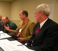
The Federal Highway Administration asked the Institute to help Pennsylvania DOT and area natural resource agencies find ways to share data needed to complete highway projects. A steering committee of agency was formed to help plan the Forum. The Forum included presentations from the different agencies on their respective missions and data needs and followed by discussions of how to address the issue of better access to species data.
...read more
Sage-Grouse Range-Wide Issues Forum
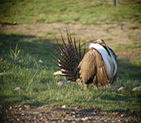
Petitions to protect the Greater Sage-grouse under the Endangered Species Act (ESA) began in 1999. The U.S. Fish and Wildlife Service ultimately decided that the listing was “not warranted.” Yet these petitions prompted states with Sage-grouse populations to begin conservation planning at the local and state levels. To be successful, individual local plans needed to be coordinated. So the U.S. Institute was asked to work with the Western Association of Fish and Wildlife Agencies to bring diverse stakeholders together in a forum.
...read more
Sawtooth National Recreation Area Planning
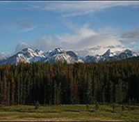
Located in central Idaho, the 756,000 acre Sawtooth National Recreation Area (SNRA) is part of the Sawtooth National Forest. The USDA Forest Service decided to develop a plan for the recreation area that was separate from, but coordinated with, the forest plan because of the recreational area's unique setting and management challenges.
...read more
Signs of the Time - Outdoor Advertising Controversy

Billboards are a familiar sight on many highways across the United States. The federal Outdoor Advertising Control (OAC) Program was set up to provide rules for billboards and other outdoor advertising signs along interstate and other highways. There has been growing controversy about the how these signs are regulated since 1965 when the Highway Beautification Act (HBA) was passed.
...read more
Sun River Watershed Collaborative Process
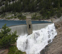
When representatives of the Sun River Watershed Group first contacted the U.S. Institute in July 2002, the Watershed Group had already been meeting for over 10 years to discuss how to reduce water conflicts among the river’s major water users. Two irrigation districts and a large ranching operation were in conflict over water rights, while fishery interests were concerned about the declining health of the Sun River. The Watershed Group approached the U.S. Institute seeking a facilitator who could work with all parties to resolve these issues.
...read more
TN FHWA Facilitated Workshop
Under Section 106 of the National Historic Preservation Act (NHPA), federal agencies must consult directly with Indian Tribes when considering actions that may affect properties of traditional religious or cultural significance to them. The Tennessee Division of the Federal Highway Administration (FHWA) and the Tennessee Department of Transportation (TDOT) engaged the U.S. Institute to help them develop a framework for consultation on transportation projects in Tennessee.
...read more
Tucson Basin Shooting On Public Lands
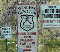
Non-hunting shooting on public lands emerged as a controversial issue during preparation of the Resource Management Plan (RMP) for the Ironwood Forest National Monument (IFNM). In May, 2002, the Bureau of Land Management (BLM) asked the U.S. Institute for Environmental Conflict Resolution for help.
...read more
Tushar Grazing Allotments
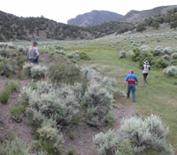
Livestock grazing on public lands in the West has been commonplace since the Civil War era. The rules governing the practice have evolved over the years. In the Fishlakes National Forest, stakeholder decided to use a collaborative process to address issues related to grazing allotments. This provided an important opportunities to evaluate impacts of grazing on public lands.
...read more
U.S. Air Force - Multi-Party Negotiation and Conflict Management Training
The U.S. Institute for Environmental Conflict Resolution was tasked by the U.S. Air Force General Counsel’s Office for Dispute Resolution to lead the development of a multi-party negotiation and conflict management training framework.
The goal was to draw on the experience and research in the field of environmental conflict resolution (ECR) to create the basis for multi-party negotiation and conflict management training where interagency and intergovernmental cooperation are essential.
...read more
USDA Forest Service Cibola National Forest Travel Management Planning
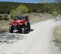
The Cibola National Forest and National Grasslands is located in New Mexico, Oklahoma and Texas and is part of the Southwestern Region of the U.S. Forest Service. The Cibola NF is among many national forests beginning travel management planning to comply with the Travel Management Rule (2005) that requires the forests to designate a system of roads, trails and areas open to motor vehicle use.
...read more
USDA Forest Service Colville NF Sullivan Creek Dam
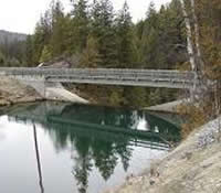
As part of decommissioning of Sullivan dam, stakeholder worked together to develop strategies for protection and enhancement of fish and wildlife habitat, native species protection, improved public recreation facilities and programs, and maintaining the regional quality of life enjoyed by residents and visitors alike.
...read more
USDA Forest Service National Travel Management Planning
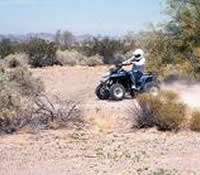
Since the 2005 the U.S. Forest Service has been engaged in travel management planning for national forests and grasslands around the country. The rule requires each national forest or ranger district to designate those roads, trails, and areas open to motor vehicles. The Forest Service has committed to using a collaborative planning process, emphasizing public involvement and coordination with state, local, and tribal governments.
...read more
USDA Forest Service Sierra NF Dinkey Project Planning Forum
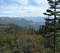
National Forests in the Sierra Nevadas face continuing controversies over the effects of timber harvest on old-growth forests and their wildlife, such as the California spotted owl and the Pacific fisher. To determine whether forested ecosystems can be managed to maintain essential components and still support a variety of uses, the Sierra National Forest teamed up with the Pacific Southwest Research Station in a proposed adaptive management study.
...read more
Vermillion Basin Plan Revision
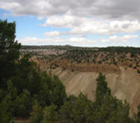
In 2004, the Bureau of Land Management (BLM) began revising its Resource Management Plan (RMP) for the Vermillion Basin area. The BLM wanted an adaptive management proposal that would employ an “out-of-the-box” collaborative planning approach. The North Colorado Stewardship (NWCOS), a newly established partnership representing a broad coalition of area stakeholders, indicated interest in working with the BLM to develop the RMP. This citizen-based approach was designed to keep the community engaged in developing landscape management goals, monitoring the process, and making appropriate adjustme
...read more
Washington Navy Yard Case

This case involved a multi-party dispute over a National Pollutant Discharge Elimination System storm water permit for the Washington, D.C. Navy Yard. The permit was issued by the Environmental Protection Agency. The U.S. Navy appealed the permit. They alleged that permit conditions involving effluent limits, monitoring parameters, and other study requirements were based on erroneous findings of fact or conclusions of law. The Anacostia Watershed Society, represented by the Earthjustice Legal Defense Fund, also appealed the permit.
...read more
West Eugene Parkway Assessment
A proposed highway through the west side of Eugene, Oregon, had been the subject of heated debate for over 20 years. Two public votes on the latest proposal, the "West Eugene Parkway," produced conflicting results. Local government administrations took different positions on the issue.
...read more